
Search Mifflin Township Streets by Address
A Mifflin Township street directory works best as a parcel-and-record trail, not as a roster. The original township has been altered by annexation, so a street name or postal city alone does not determine the right jurisdiction. Franklin County records supply the current parcel context, while dated records can support a narrower historical connection. Start with the address in the Auditor service, keep the parcel ID and legal description, and then move to the source that matches the question.
- Enter the address number and street name in the Franklin County Auditor Property Search. Record the parcel ID, situs or location address, jurisdiction wording, legal description, and tax-year context.
- Open the matching parcel in the Franklin County Parcel Viewer. Check the parcel shape, street frontage, subdivision, annexation, and adjacent parcels before treating nearby numbers as one sequence.
- Use the Treasurer property search to compare location and billing fields. Keep the billing field separate because it is a tax-correspondence address, not proof of an occupant.
- Take the parcel number and legal description to the Franklin County Recorder Public Records Search. Follow the recorded transfer trail by parcel or legal description rather than a loose street-name query.
- For a dated person-level check, use the Ohio Secretary of State Voter Lookup with a known first name, last name, and Franklin County. It is a targeted confirmation route, not a by-street list.
- Where an address falls within an eligible historical directory area, compare it with the Columbus Metropolitan Library directory collection and retain the volume date.
That order keeps property geography, recorded ownership, and dated person evidence from being blended together. It also gives a repeatable street-by-street method when records use Columbus, Gahanna, or Mifflin Township labels for related land.
Mifflin Township Address-to-Parcel Tools
The Auditor is the essential bridge from a Mifflin Township street address to the county parcel record. Its documented address mode takes a house number and street-name component, and searches both parcel and building addresses. The service also has parcel-number and owner-name modes, but an address search is the safer first step for a street inquiry. A name can appear in more than one ownership position, while the parcel ID anchors the next record checks.
The Auditor’s online-tools page brings the property and map services together for this exact handoff.
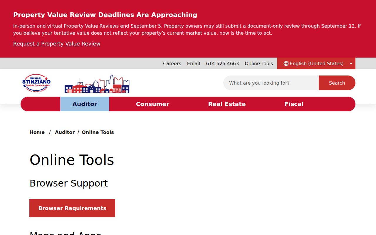
The tools shown there support parcel identification first, then map context. A profile can show property and value context as well as routing information, but it should be read as a current public property record rather than a complete household list.
| Auditor field | Mode | Required | Street-directory use |
|---|---|---|---|
| Parcel Number | Parcel search | Yes for parcel mode | Reopens the identified county parcel. |
| Street Name | Address search | Yes for address mode | Supplies the road-name component. |
| Address Number | Address search | Yes for address mode | Supplies the house-number component. |
| Owner Name | Owner search | Yes for owner mode | Supports a later, targeted record check. |
| Page Number, Page Size, Sort Column, Sort Order | Result controls | No | Manage a result set without changing the address terms. |
Note: Ownership and tax-year fields can change, so preserve the date viewed with the parcel ID and legal description.
Mifflin Township GIS Street Sets
The Parcel Viewer offers a more defensible way to group parcels on a Mifflin Township street. Its documented methods are Search Parcel Data By Shape, By Value, and By Spatial. Value search can use attributes such as parcel ID, subdivision or condominium, annexations, and special tax district. Map selection and the property pop-up provide a route back to the Auditor profile for each result.
The Auditor API documentation records the address and owner query patterns that complement the map work.
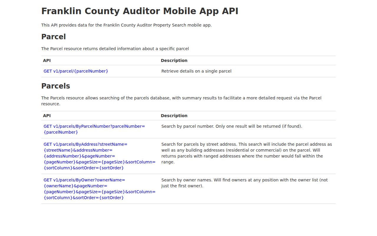
Use the map results as an auditable parcel set, then inspect each property record individually. The viewer does not promise a public current-occupant field or a street-browse tab.
Spatial search accepts a distance buffer. Choose Fully Within when every returned parcel must lie inside that buffered area; choose Intersecting when parcels touching or crossing the area matter. The viewer can export result data as CSV, which preserves the parcel set for later comparison without guessing at lot lines.
Mifflin Township Street Record Terms
A few field names prevent common errors in a Mifflin Township street directory search. They describe different kinds of evidence, and none should be used as a shortcut for proving an entire household.
- Parcel
- A county-identified piece of land used to connect the Auditor, Treasurer, Recorder, and map records.
- Situs address
- The physical location or property address shown in a property record. It can differ from a billing or mailing address.
- Plat
- A recorded subdivision or lot plan that helps relate a legal description to mapped land.
- Criss-cross directory
- A reverse-style directory arranged by address or street, useful as a dated clue where the volume covers the location.
A sample Auditor property profile illustrates why local routing fields deserve close reading.
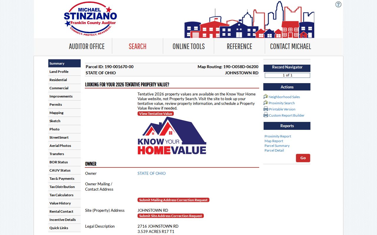
The inspected profile uses the routing wording “MIFFLIN TWP EXC GAHANNA CITY.” It demonstrates that township and municipal labels must be retained separately. It does not support copying any person-specific details into a street list.
Mifflin Township Records by Street
Each address-keyed source answers a particular Mifflin Township street question. The parcel ID is the durable handoff between the property profile and the Recorder, while the map explains proximity and boundary context. A record should be described at the level it actually supports, especially when tax correspondence, title, and a dated person record point to different facts.
| Address record | Keeper | What it can show | Access channel and caution |
|---|---|---|---|
| Auditor property profile | Franklin County Auditor | Parcel ID, location or situs, ownership and appraisal context, routing | Address, owner, or parcel search; live fields change with updates. |
| Parcel Viewer | Franklin County GIS | Parcel geometry, adjacency, annexation, subdivision, and special-district layers | Map click, value, shape, or spatial selection; geometry is not title proof. |
| Treasurer property profile | Franklin County Treasurer | Location, billing address, current owner, tax and legal-description context | Name, street address, or parcel search; billing is tax correspondence. |
| Recorded instruments | Franklin County Recorder | Legal description, parcels, parties, document dates, and transfer references | Public search, counter, and archival index paths; not street-indexed. |
| EDP files | Franklin County Economic Development and Planning | Public zoning, building, code, or inspection context when available | Request the address or parcel file; no complete public case-search field set was captured. |
| Dated directories and voter lookup | CML and Ohio Secretary of State | A dated address clue or targeted voter confirmation | Collection or individual lookup only; neither is a streetwide residents roll. |
For a person-centered question after the address is fixed, the Mifflin Township resident lookup route keeps the name-verification work distinct from the street chain.
Mifflin Township Recorded Transfer Chain
The Recorder is not an address directory. Its guidance directs researchers to find the parcel through the Auditor, then search the Recorder by parcel number or legal description. The public entry point offers Cloud and Legacy search routes. Keep the instrument number, book or volume and page, recording date, parties, and legal description together when following a transfer along a Mifflin Township street.
Coverage changes by era. The Recorder’s guide places online deed access from January 2, 1914 and archival deed-index research from 1804 through 1913, including the Grantee Deed Index 1804–1888. For records after May 15, 1997, retain the 15-digit instrument number. For October 10, 1980 through May 14, 1997, use the microfiche-derived volume and page; earlier records use book, volume, and page. The Recorder counter and archival path remain important when the online era does not reach the document.
Note: A recorded party or tax owner is a record-role finding, not a stand-alone statement about present occupancy.
Mifflin Township Street Labels and Annexation
Mifflin Township is a civil township, not a municipality. Its 1811 territory was changed by annexations into Columbus and Gahanna, which is why a current street address can carry a different municipal or postal label while a historical source still names Mifflin Township. The Township About page describes the remaining unincorporated northeast Franklin County area and service setting.
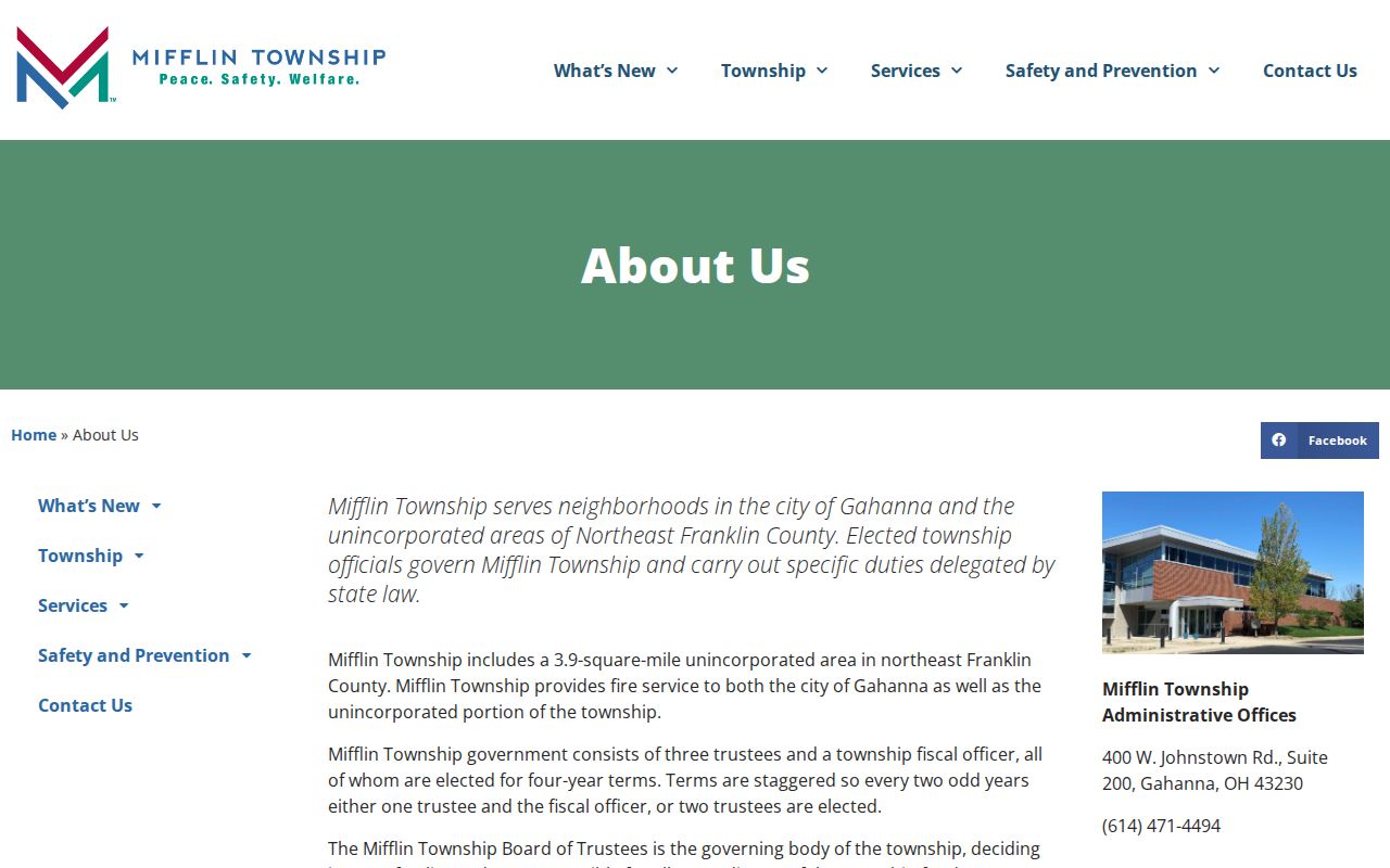
Read township, municipal, USPS city, ZIP, and legal-description fields independently. A missing historical street address may call for a name, legal-description, historic-map, or later municipal search. No official Mifflin-specific street-renumbering date was located, so no renumbering rule should be assumed.
Mifflin Township Voter Check After Mapping
Ohio’s voter tool is a narrow, individual search route. It requires first name, last name, and county, with Franklin selected for a Mifflin Township search. Use it only after the address form and jurisdiction have been normalized through the Auditor and GIS. The result can be a dated public registration lead for a specifically named person, not proof that every person at an address has been identified.
The local administrative channel is the Franklin County Board of Elections. The Ohio voter-data request service is a separate, time-limited extract channel, while the lookup form remains the appropriate individual check. Protected categories and nonpublic information remain excluded under Ohio law, and an absence can reflect a different name, a move, confidential status, or no matching record.
Mifflin Township EDP Address Files
For the remaining unincorporated area, the Township directs zoning and building matters to Franklin County Economic Development and Planning. A specific public file can add a dated property-context record after the parcel is known. Give the office the exact address and parcel ID, and ask whether a zoning decision, inspection record, building file, or other responsive public record exists. The reviewed material did not capture a complete public permit-case search or a historical coverage start date.
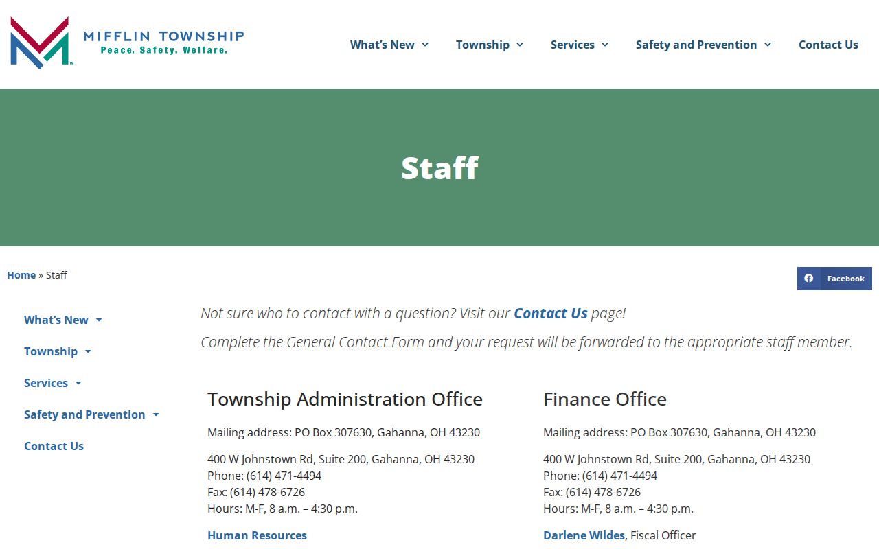
The Mifflin Township staff directory is a practical local contact source when a township service or remaining-area question needs routing before a request.
That route avoids treating a city mailing label as an answer to jurisdiction. For a public-records request to an Ohio office, describe the parcel, address, record type, and approximate date range clearly so the custodian can identify responsive material.
Note: Ohio Public Records Act requests concern records held by the custodian, and access remains subject to the applicable exemptions.
Mifflin Township Historical Street Listings
Columbus Metropolitan Library materials can contribute a dated street clue, not a universal township roster. The library reports holdings reaching to 1841, and its House History guidance says street listings begin in 1911. Before 1920, Columbus directories cover addresses within corporate limits. Because Mifflin Township land was annexed over time, an omission from an older Columbus volume may reflect coverage rather than a missing person or building.
Use the volume’s title and coverage statement, then pair an address clue with the parcel’s legal description and other dated sources. The historical collections are treated in depth on the Mifflin Township city directories page. This keeps the street directory focused on the address-to-parcel sequence while preserving the historical shelf as a separate evidence channel.
Mifflin Township Street Directory Limits
Street research has useful limits. Parcel geometry identifies land, a Recorder instrument tracks a recorded transaction, and a Treasurer billing address identifies a correspondence destination. None of those, by itself, establishes a complete current household. The same caution applies to a voter match, which is tied to a particular named search and public availability rules. Preserve the source, date viewed, parcel ID, and what the record actually says.
When a result raises a privacy concern, use the custodian’s current official channel rather than trying to fill gaps through unrelated records. Ohio’s Public Records Act opens nonexempt records held by public offices, but it does not erase confidentiality rules or turn every address-related field into a resident list.